Quantitative methods need to be successful not only in identifying efficient sets of areas to represent diversity, but more particularly in ensuring viability and dealing with threat to ensure the persistence of biodiversity. So how might the likelihood of persistence be improved? In order to avoid some of the problems of compromising accountability that are apparent with combinatorial scoring methods (ref 8), the additional viability and threat criteria might be applied in separate steps within a sequence or hierarchy of decisions. The idea is to retain accountability through making it possible to say exactly why each species or area is included or excluded at each step of the analysis.
One sequential structure for an area-selection exercise consists of a series of 'steps':
A treatment of viability and threat could then be integrated at any of these steps.
1.
Prescription: values and goals
Prescription concerns deciding the values
and goals for an area-selection exercise. Any area-selection procedure
must begin with a clear idea of which value areas are to be chosen to represent.
This is needed for a well-defined goal, so if the value to be conserved
is in biodiversity, then decisions have to be made as to (1) which diversity-value
surrogates to use; (2) which areas to choose among (i.e. their location,
grain size, and the extent of the survey area); and (3) which representation
target is to be achieved.
2.
Preselection: viability etc.
Preselection can be used to restrict which data (areas, species and
records) from the raw data are to be included as candidates for selection
during the main selection stage. This is done to tailor the data for pursuing
the goals established at the prescription stage. One possibility is to
exclude records for particular species from those areas where they have
very poor viability prognoses.
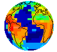
Probability models have been used previously for interpolating the expected distribution of moderately well-known and moderately widespread species (ref 5). The example below shows how spatial information can be used to model niche space, which may then be used (upper row) to predict the expected distribution among unsampled areas. However, in a potentially interesting alternative, probability models could also be used to seek 'viability centres' for each species (lower row). This might be achieved in part by increasing the threshold probability of occurrence for admitting records from the raw data so as to filter out all records from areas with lower habitat suitability (ref 13). The procedure differs from excluding geographically marginal areas in that it goes more directly for ecologically central areas, within niche space, rather than within geographical space. It may be possible to generate reasonably predictive niche models from distribution data and climatic data alone, without detailed autecological studies of each species, so that the process might be automated for dealing with larger numbers of species at relatively low cost (below):

3. Selection:
efficiency
Selection is used to choose a set of areas for priority conservation
management. Efficiency in representing biodiversity value comes from using
complementarity-based algorithms
(iterated sets of rules) applied at the main selection stage. This has
often been seen as the primary purpose of this stage. Efficiency is important
because the area of land available for conservation is usually limited
and because there is often competition between conservation and incompatible
land uses for managing particular areas.
Selection for minimum-area sets for complete representation (one or more of everything) may be sought using either slower optimising techniques or faster but approximate heuristic techniques. The practical advantage of speed from heuristic techniques when dealing with large datasets has come to be appreciated because it allows for the inter-active assessment of priority areas (ref 8).
Selection of maximum-coverage sets for representing as much diversity as possible within a given number of areas (or for a given level of investment) can also be sought using either optimising or heuristic techniques. Heuristic techniques have long been used, such as the 'greedy' selection of ordered sequences of areas by complementary diversity (ref 1) which can be combined with redundancy tests. However, this technique becomes unreliable as the number of areas approaches the size of the minimum set. The results may then be checked against an alternative technique, such as the simple expedient of re-ordering a heuristic near-minimum set of areas by their diversity complements (ref 5). This has been shown to provide a particularly good series of solutions to these maximal coverage problems for more nearly complete sets (ref 11). In the example below this technique is applied to a very small data set at a very large spatial scale, but nonetheless it illustrates the point. When seeking to represent all of the species, the 12 areas together present a near-minimum-area solution. But when seeking to represent as many species as possible within just ten areas (a maximum-coverage problem), the first ten areas from this list would be a good approximation to the optimal solution (areas 11 and 12 would be flexible alternatives for areas 8, 9 or 10, because each contributes a single species) (below):
| Area choices: | Species richness: | ||||
| step | area chosen | absolute | increment | cumulative | (%) |
| 1 | Ecuador | 10 | 10 | 10 | 23.26 |
| 2 | Kashmir | 9 | 9 | 19 | 44.19 |
| 3 | Turkey | 7 | 6 | 25 | 58.14 |
| 4 | Michoacan | 4 | 4 | 29 | 67.44 |
| 5 | C Bolivia | 8 | 3 | 32 | 74.42 |
| 6 | N California | 4 | 3 | 35 | 81.40 |
| 7 | Irkutsk | 5 | 3 | 38 | 88.37 |
| 8 | Afganistan | 5 | 1 | 39 | 90.70 |
| 9 | Qinghai | 8 | 1 | 40 | 93.02 |
| 10 | NE India | 5 | 1 | 41 | 95.35 |
| 11 | Uzbekistan | 4 | 1 | 42 | 97.67 |
| 12 | Big Horn | 4 | 1 | 43 | 100.00 |
Alternatively, if threat were unknown or could not be modelled, then the diversity complement could be used to ensure that the most diversity could be secured first against unpredictable threats (ref 5, ref 8).
5.
Postselection: inter-active exploration of flexibility
Postselection may be used to explore the consequences of modifying
a selected area set to satisfy additional criteria. This is where the high
speed of heuristic selection algorithms
on widely available computers has a particular advantage, because it permits
truly inter-active exploration of areas (ref
8).
One advantage of the complementarity method is that it enables precise identification of the goal-essential species that justify the inclusion of an area in an area set. For minimum sets with a goal of a single representation for each species, the goal-essential species are those that occur in only one area within the area set. Some of these species may indeed occur in only one area within the extent of a particular survey, in which case their unique presence makes the area irreplaceable to achieving the representation goal. However, most species are usually more widespread, so that other areas where they occur provide flexibility for area selection.
Using this information on goal-essential species, it becomes possible to map the selected areas as irreplaceable or as flexible, and to count the number of goal-essential taxa in each area. Alternative area choices can then be applied manually so that other criteria can be explored. If necessary, the new selections can be tested for their effect on efficiency by re-running the area-selection algorithm and re-prioritising. This can be used to assess the sensitivity of particular area sets to the loss of particular areas.
Furthermore, because the goal-essential species in each selected area are known and so too are their distributions (in the British birds example below, for the selected Welsh cell SH60 with the black spot, this includes the Chough listed in the window on the right), it is possible to plot maps of species richness in just these species. In effect, these are maps of flexibility for the selected areas within a particular set (ref 13). Any one of the other areas on these maps that has all of the same goal-essential species as the selected area under consideration (shown in red in the example below) is therefore a perfectly flexible alternative. Thus flexibility can be exploited to find a modified set of areas that is equally efficient and equally easily justified. Areas with fewer of the goal-essential species (shown in dark blue) are only partially flexible, so that choosing them in place of the first area will reduce efficiency (below):
 |
Link to image showing a map of flexibility for a selected area in west Wales. |