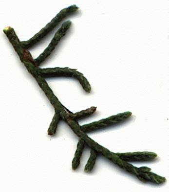
Foliage [C.J. Earle].
Common Names
Modoc, Baker or Siskiyou cypress (1).Taxonomic notes
Syn: Cupressus bakeri Jepson subsp. matthewsii Wolf; C. macnabiana Murray bis var. bakeri (Jepson) Jepson (3).Description
"Trees to 30 m; crown broadly columnar, sparse. Bark smooth at first, later building up in layers. Branchlets decussate, 0.5-1.3 mm diam. Leaves with conspicuous, pitlike, abaxial gland that produces drop of resin, slightly glaucous. Pollen cones 2-3 × 2-2.5 mm; pollen sacs 3-5. Seed cones globose, mostly 1-2 cm, silvery, not glaucous; scales 3-4 pairs, usually covered with resin blisters, umbos often prominent, those of distal scales erect, to 4 mm. Seeds mostly 3-4 mm, light tan to medium brown, not glaucous to slightly glaucous" (3).Range
USA: Oregon and California at 1100-2000 m elevation in mixed evergreen forests of the Siskiyou Mountains; of conservation concern (1, 3). See also (6).Big Tree
Height 39 m, dbh 104 cm, crown spread 9 m, in Rogue River National Forest, OR (2).Oldest
Dendrochronology
Ethnobotany
Observations
Little (4) reports an accessible grove at Miller Lake, near Steve Peak in southeastern Josephine County, OR. Details on access to this grove are likely available from Wolf (5), but I haven't seen this publication yet.Remarks
"The northernmost grove of cypress in the New World is a nearly pure stand of 2 acres [0.8 ha] of Modoc cypress, Cupressus bakeri Jeps., on the Rogue River National Forest 4 1/2 miles [7.2 km] west of Prospect and about 30 miles [48 km] northeast of Medford, Jackson County, Oregon. This isolated station was first reported in 1953 by Oliver V. Matthews, of Salem. An authority on Oregon Trees, he collected herbarium specimens (Matthews s.n., Sept. 30, 1953; UC, US), took photographs of the trees, and gave publicity in newapaper articles."Flounce Rock Grove" had been known since 1926 but was considered to be a juniper. The trees reached a height of 75 feet [23 m] and trunk diameter of 22 inches [56 cm]. The exact locality is SE 1/4, SW 1/4. Sec. 33, T. 32 S., R. 2 E., the latitude 42°45' N., and the altitude, 4,000 feet [1220 m]. The highway between Medford and Crater Lake National Park passes within 3 miles [5 km] of this grove. However, the site is not readily accessible because of rough mountainous topography and absence of a trail. This locality represents a range extension of about 60 miles [96 km] northeast from the Steve Peak area in the Siskiyou Mountains of southeastern Josephine County. ... The name Cupressus bakeri ssp. matthewsii C. B. Wolf (Aliso 1:83, figs. 3 C, 7 B, 22. 1948), Siskiyou cypress, was given to the northern populations. However, the characters in the key (p. 72-73) seem scarcely sufficient for division of the species into 2 varieties" (4)."Reports of Cupressus from the State of Washington represent introductions. The Forest Service Herbarium has a specimen of Cupressus macrocarpa Hartw. from near Ilwaco, Pacific Co., about 10 miles [16 km] N. of Columbia River, recorded by the collector Everett Miller as 24 in. [60 cm] D.B.H. and"apparently native." My inquiry some years ago led to information about a plantation there. The coastal strip has a mild, subtropical climate" (4).
Citations
(1) Peattie 1950 .(2) American Forests 1996 .
(3) James E. Eckenwalder at the Flora of North America web site .
(4) Little 1970 .
(5) Wolf 1948 .
(6) Robert S. Thompson, Katherine H. Anderson and Patrick J. Bartlein. 1999. Atlas of Relations Between Climatic Parameters and Distributions of Important Trees and Shrubs in North America. U.S. Geological Survey Professional Paper 1650 A&B. URL= http://greenwood.cr.usgs.gov/pub/ppapers/p1650-a/pages/conifers.html, accessed 22-Jan-2000.
See also
Elias 1987
.
Little 1980
.
[ Cupressus ] [ Cupressaceae ] [ home ]
This page is from the Gymnosperm Database
URL: http://www.geocities.com/~earlecj/cu/cup/bakeri.htm
Edited by Christopher J. Earle
E-mail:
earlecj@earthlink.com
Last modified on 22-Jan-2000